The Unknown Below the Surface: Reviewing the Geotechnical Report
by John Bolton, on June 03, 2026
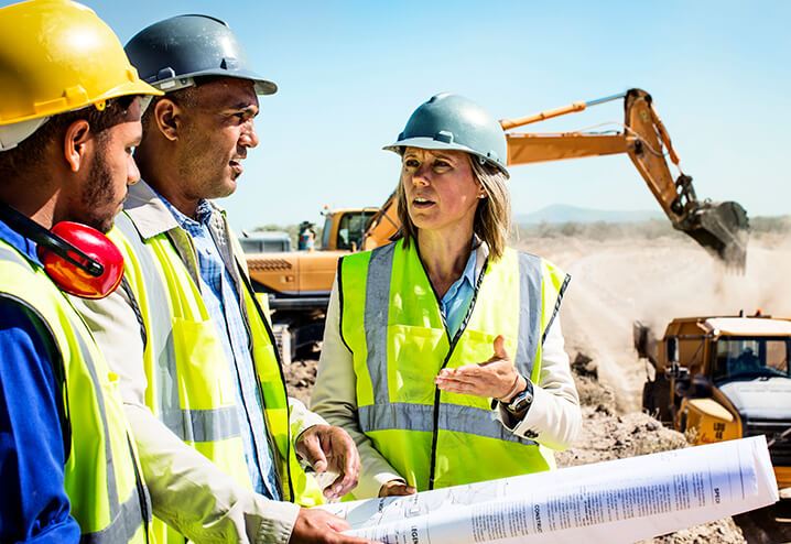
When it comes to site work, the Geotechnical Report is an indispensable source of information that helps you make smart key decisions related to site access, pavements, foundations, working surfaces, and other site conditions.
The key to getting the most from this report is knowing how to quickly extract the most meaningful information from it when you’re short on time. Below is a step-by-step review of a typical report, with guidance on what to pay attention to when, identifying site-specific challenges, understanding what’s most important when time is critical, and using the report in day-to-day work.
Unpacking the Report—One Section at a Time
Geotechnical reports usually include a high-level overview of the site; a discussion of field testing that’s been conducted, soil characteristics and mapping; recommendations; and appendices with supporting data like site maps, general site topography, locations of borings and boring logs, and subsurface strata mapping and classifications.
Looking for a detailed look at each section? Use the list below to navigate straight to it:
Need help on your site?
Get on-the-ground support from a Tensar expert. Our team offers free site visits to help you make confident, informed decisions.
1. Start with the Summary
The summary gives you a big-picture view of the site characteristics, history, anticipated challenges and recommendations, and often reveals whether an adequate geotechnical investigation was conducted, or if more work is needed.
Scan the location map and general/concluding comments. If you’re familiar with the area or have worked on nearby sites, the information in the report may align well with your first-hand knowledge of local soils.
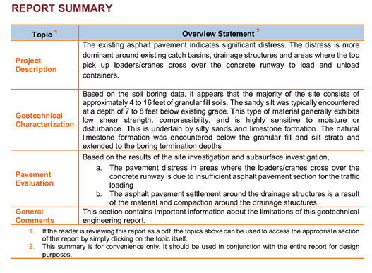 Example Summary
2. Take a Closer Look at Pavement Recommendations
Pavement recommendations include the design method or procedures used, anticipated traffic counts and/or loads, thicknesses of the various layers of the pavement structures, and other variables used in design. These details become the basis for analyzing other potential pavement options.
The Pavement recommendations often include details on subgrade preparation that may illuminate alternative options that would work well while cutting material costs, saving time in the subgrade preparation process, or both.
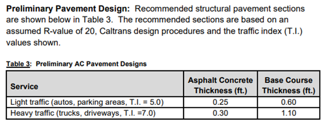 Example Pavement Recommendations
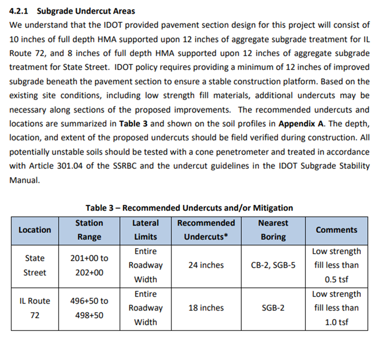 Example Subgrade Preparation Recommendations
3. Get a Lay of the Land with Site Topography
Reviewing the general topography map will quickly shine a light on potential problematic site conditions or features, including:
Earthwork Operations:
- Volume
- Site balancing
- Potential haul-off or structural fill needed
- Boundary or geometric constraints
Other:
- Low, poor-drainage areas
- Wet-weather-related challenges
- Proximity of water table location and water features to planned structures; and proposed loading conditions for buildings, roadways, or other improvements
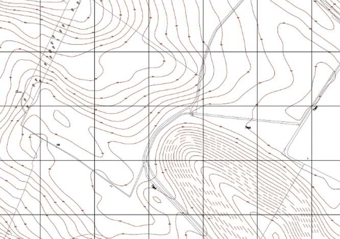 Example Site Topography Map
4. Know the Soil Situation with Borings and Locations
Reviewing the boring location map and soil boring logs is another key to having a good general understanding of the subsurface strata, as it features information like:
- Distances between boring data points
- Plans for areas with no boring data
- Location of the water table and any pockets of variable, organic, or contaminated soils
- Insight into problematic areas (indicated by borings with the weakest subgrade soils, in these instances it’s important to review the site plans, so that you know what’s currently planned in these areas—and are prepared to find options to address specific conditions)
As you review the information in the boring logs, keep in mind that undisturbed soil strength data may begin as much as two feet below the ground surface. Depending on the grading plan, improvements like pavements and working surfaces may require more information—as they may be built directly on existing surface soils. A site visit and field testing with a Dynamic Cone Penetrometer (DCP) or vane shear device usually yields the additional necessary information.
Want to go deeper? 
Watch our 30-minute webinar, The Unknown Below the Surface: Efficient Use of Geotechnical Reports, and earn 0.5 PDH credits.
Short on time? 
Get a quick overview in our 5-minute Geotechnical Report Review Beneath the Build video on YouTube!